Sunday, November 23, 2008
Taking it Easy
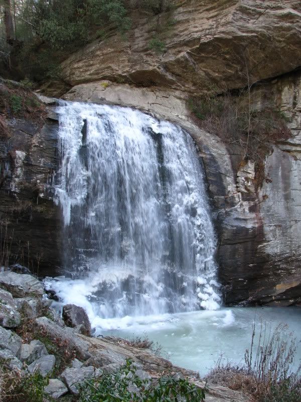
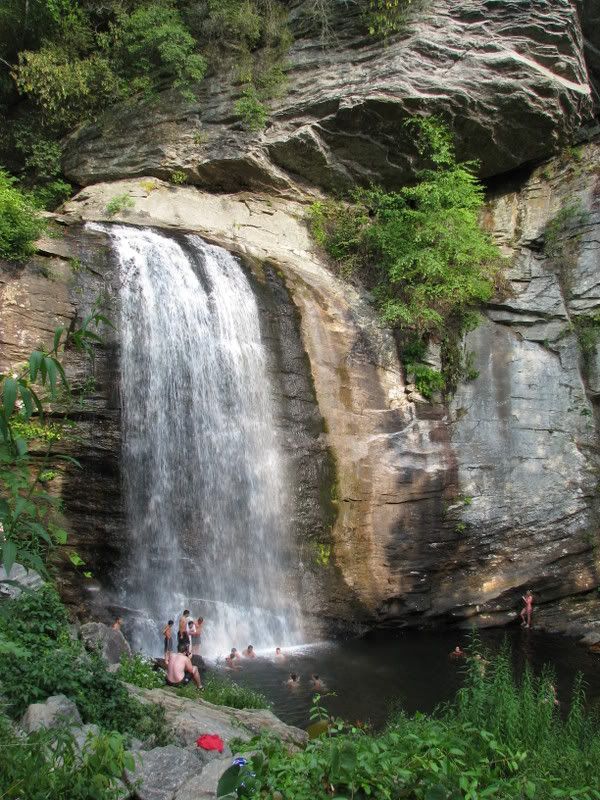
The lure of Pisgah is just too great and by mid morning on Saturday I decided I’d had enough and threw the dog in the truck and headed for the hills. I was thinking about parking at Black Balsam and heading for Tennent Mountain on the Art Loeb so I headed down 280 and then took 276 into the forest. I was wondering if the parkway was going to be open and was trying to think of hikes I could do if it wasn’t. A quick stop at Looking Glass Falls had me thinking that things could be bad up on the parkway and it would be closed:
Things sure have changed since August:
After that we kept on heading up been when I saw Yellow Gap Rd. on the right Thompson Creek popped into my head and I headed for it. On the gravel drive the woods were alive with hunters and when I pulled up to the trail there were two hunter vehicles parked there. I was wondering if it was deer season yet and wondering if this was a good trail choice. I wanted to let Duma run so I hoped it wasn’t deer season and hoped they were hunting on the opposite side of the road and we headed up. Not shortly after we came across a hunter on his way down and he said deer season starts Monday and he had just been scouting.
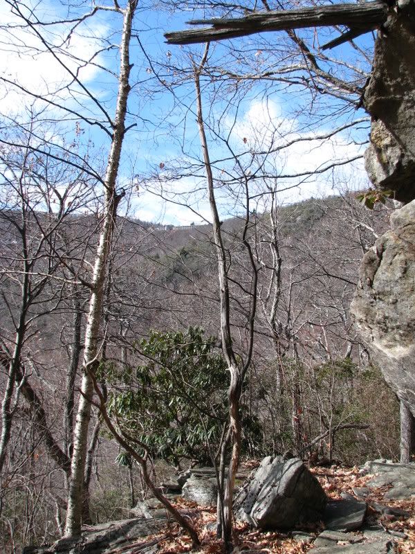
Although I’m disabled and trying not to stress my knee we made good work of the climb and within an hour were just below the Pisgah Inn:
Sunday was spent relaxing but by mid afternoon I had the itch again and since the bike is in pieces I had no choice but to once again throw the dog in the truck and go for a hike. It was already almost 4pm and I really don’t want to extend this injury anymore so I decided not to do much and headed for the Art Loeb right at the forest gate. The Art Loeb has been on my mind a lot recently and one of the prominent things on my To Do List is to through hike it. I figure it will take me 20 hours or so and aren’t sure that Duma can go that long (I blame everything on the dog) so think my best option is to plan to stop for the night at the Deep Gap shelter… But that’s another day. This hike wasn’t much, just an out and back to the intersection with 5062 but the afternoon sun was warm and the north slope of the trail let us soak it all in - a nice treat at the end of the day!
Hiking is fun. Hiking with big yellow crazy dogs is even more fun and I’m itching to do more of it. I’ve been wanting to do Cold Mountain for a long time and think that the time might soon be at hand. Thursday is a holiday and I’ve go no plans so if the knee feels up for a ten mile wilderness hike I’m gonna do it. For added motivation I picked up a few of these: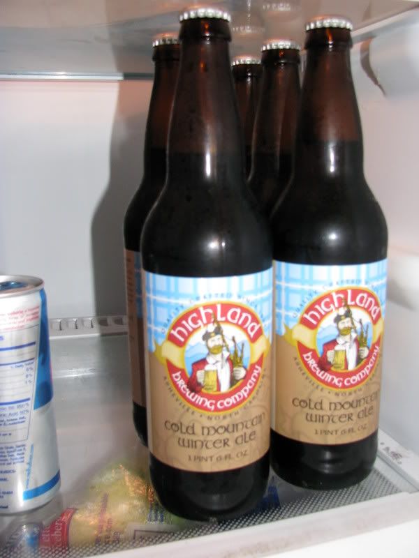
Only question is how many do I make the dog carry to the top?
Tuesday, November 18, 2008
The Disabled List
That’s it. I’m done for awhile. No more bikes or hikes until my knee doesn’t hurt anymore. I don’t know what is wrong with it except for that it hurts and it really hurts after I go for a ride or hike. I’ve been trying to pretend that nothing is really wrong with it and have also been pretending I’ve been taking it easy but realized today when I couldn’t hardly move, much less walk that perhaps a five hour Pisgah ride once a week isn’t taking it easy after all.
Saturday started nicely enough with an early morning rainbow over Stoney Mountain when I got up and took Duma out. After that calls were made and a plan was hatched and a pot of coffee and a couple of bowls later I was at Black Mtn. Meeting Jonathon and Dennis for a little spin. Our route for the day would be:
276 > 477 > Bennett Gap > Coontree Gap > 276 > 475 > 471 > 471D > Butter Gap > Cat Gap > 475 > 276 > Coontree Gap > Bennett Gap > 477 > 276
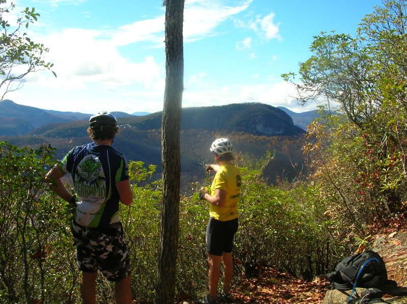
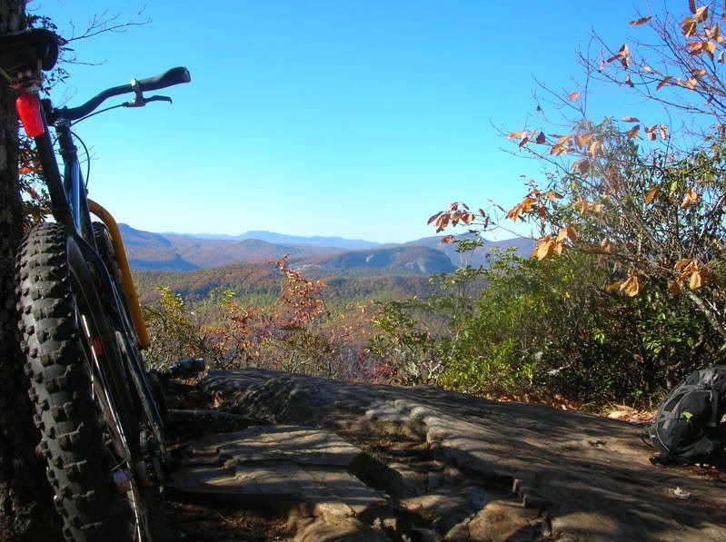
We got a slow start including a relaxing stop at White Pines where Jonathon filled up his water bottles and I discovered my rear hub was loose. Oh, well and off we went. I was feeling good and went into the climb strong holding Dennis’s wheel. About half way up when it starts to get steep my knee started to really hurt so I let Dennis go and tried to just keep going. Shortly after that I decided that I would just head home after Coontree and then before I knew it the climb was over and we were headed on down Bennett. We stopped for a healthy break at the overlook and marveled at how spectacular of a day it was and how lucky we are to live where we do.
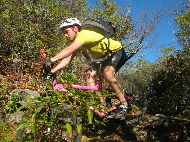
After that more crazy good singletrack. Here is Dennis cleaning the rock switchback:
I had already been on Coontree three times this season and feel pretty good on it and lead the first descent down to the log staircase. It is a super fast trail and the new leaves only added to the thrill! I took advantage of my prior time on the trail this year to ride the lower two little stream crossings and then we were off on down the road to the Hatchery. Coming down Bennettt and Coontree was so much fun that I had forgotten about my knee and decided I had to get my Butter after all.
By the time we hit Davidson River Trail my knee hurt again and I was wishing there was some sort of magical shortcut by which I could get to the top of Butter without any more climbing. That wasn’t going to happen and I would have to pay for my Butter. We stopped at the gap where Jonathon put on knee warmers and I saw my second rainbow of the day. The forecast had been for rain all day and there was a storm blowing right on our heels and we took off down Butter knowing that mother nature had no chance of catching us on the downhill!
276 on a Saturday afternoon in the Fall is not a nice place to be so Jonathon and myself decided to do the Coontree > Bennett option while Dennis went on down the road. Coontree really is not a bad climb. The bottom half is pretty rideable and then the top half is just five little pushes with a little riding thrown in for good measure and then you are there. Not surprisingly it hurt during the Double Dare, after all I had been on the bike for 22 hours at that point, but this past Saturday it really hurt as well. I was done and was barely moving up the mountain. Riding once again wasn’t an option and I was pushing as slow as I have ever pushed. No matter how slow you push you always get there eventually and that I did. The reward: a little bit more of sweet Pisgah singletrack descending!
And that was it. 30 miles of Pisgah and I’m feeling every one in my knee right now. Injuries suck and it it is clear I have one so I’ll be hanging out on the sidelines for a little bit.
Monday, November 10, 2008
November and More
After those first two crazy fast miles the trail levels out a bit as it follows the creek down to the reservoir where you get to mellow out and peddle a bit instead of just holding on and praying. This is still Pisgah though and there are more than enough hungry rocks and wet slippery logs that you had better not get too comfortable and your eyes had better not wander far from the trail. This goes on for three more miles with a few nice, big stream crossings. It never hurts to try but good luck on riding any of these.
Saturday I was up early and after a little poking around I decided I’d go for a bicycle ride. But where? Well, it has been a few months since I’d been on Big Creek so I figured it was due. But how? Well, me knee really hurts and I was tempted to try and make the climbing as gentle as possible and climb up 5000 to the parkway but a twelve mile gravel/parkway climb sounded miserable when there was Laurel Mountain just up the road. So, it was decided and off I went.
I really like the whole climb up to the Blue Ridge Parkway from the Mills River Campground. 1206 is a nice but stout little climb. It gracefully works its way up the mountainside to Yellow Gap where it spits you out onto Laurel Mtn. and from there it is just miles and miles of more gentle climbing except for now it is sweet singletrack instead of gravel. I was feeling good even though the knee really hurts and made my steadily up the mountain and I decided to mix things up a bit I’d go over the top of Pilot Rock trail instead of Laurel to get to the BRP.
I don’t ride the top stretch of Pilot often but that will change. It is really a special and unique section of trail that I should enjoy more often. I usually find myself taking Laurel as I like the whole mossy covered rock other world thing but Pilot is more ridable and also has many kickass views. It rained Friday night and with the wind and rain down came the leaves and while the trails were hidden under a psychedelic carpet the views were opened up and I found myself stopping often to soak it all in. As you climb to the top of Little Bald Mountain you are rewarded with views of Asheville and beyond over your right shoulder while over your left shoulder looms the rest of Pisgah and beyond. Worth checking out.
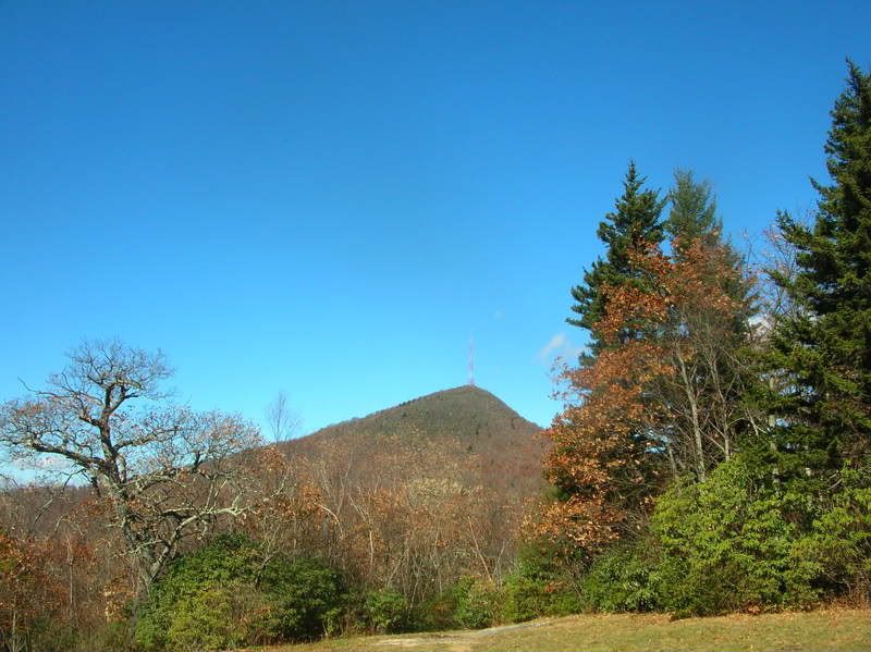
I didn’t take but a few crappy pictures all day but here is one of Mt. Pisgah:
Sunday’s to relax. Sleep in, big breakfast, a whole lot of nothing and then: How about a hike? Okay, don’t mind if I do!
The destination was clear - John Rock. Knee or no knee, sunset or no sunset, leaves or no leaves I was going to get that checkpoint.Terri, Duma, and myself started off from the hatchery and decided to do the Cat Gap loop counterclockwise:
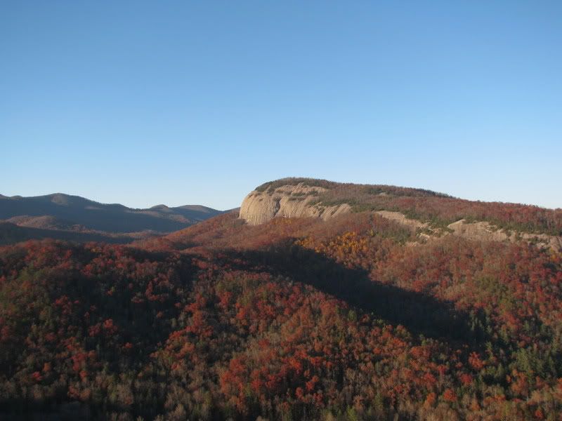
Cat Gap > Cat Gap Bypass > John Rock > Cat Gap was our route for the day and it was sweet. Counterclockwise meant we were saving the view for the end and taking the more meandering route to the top of the rock. My knee really hurt so I did the only logical thing I could think of and ignored it. After a few hours of hiking we finally made it to the top of John Rock. We were only a few minutes before sunset but decided not to stick around and headed down after a few snacks. It was a cold but fast return trip and by the time we made it back to the truck it was dark and the moon was up and we were the last people to make it out of the hatchery lot.
Friday, November 7, 2008
Yellow Gap Exploring
I’ve been paying special attention to a few things recently when I’ve climbed 1206 and recently developed a strong hunch that there might be a little bike legal detour on the climb up from the campground. There are a few gated roads that are not on the map but are clearly signed and not designated wildlife rd. and after consulting the map and studying the contour lines I deduced that perhaps two of them connected and wanted to check it out.
As I was gearing up I noticed how much crap Duma has added to his kit: blaze orange safety vest, red led blinkie and a bear bell. He doesn’t care what I put on him as long as he gets to run. I should really load his pack up with beer more often!
It was a great night to be in the woods with warm temperatures and the leaves in full bloom. We headed down a leafy grass road and I felt confident that I was right and the roads would connect. By my calculations the road I was on would slowly drop around into a cove to a creek and then would slowly climb back out of and around the cove and then meander a bit before hitting 1206 again. Everything was going perfectly and with the setting sun the bright yellow leaves were really mind blowing and I couldn’t help reflect on how fitting of a name Yellow Gap really is. But then at the bottom of the downhill there was the little creek, as expected, but on the other side there was nothing. No more road. No trail. No animal track. Nothing. So, we backtracked back out and explored a few little side tracks that all quickly petered out. By this time it was full on dark and here I was out exploring unmapped roads in Pisgah and for a brief second wondered if that was a good idea. But then I saw an old road off to the left which according to my recently revised calculations could very well be the road I was looking for so I couldn’t help but to take it.
After a quick little climb and then some scrambling through some dead fall I was once again descending a leafy old double track. Me and Duma followed this for a few miles and then right when I was sure we were going to hit 1206 it ended abruptly. So, we turned around once again and worked our way back to the truck. I still think think the roads link up somehow and will go back again and search some more….
Monday, November 3, 2008
Time Zones
Either way I still managed to squeeze in a good ride on Saturday when I was still trying to deny that my knee really hurts bad. It was very cold out when I started so I decided climbing was in order and headed straight up Black Mtn. My plan to was head over to the Hatchery and from there hit Butter Gap and then take Horse Cove Rd. over to the North Slope but I didn’t know how I was going to get there and wasn’t sure that I wanted to be out for that long. No worries, I had plenty of time to think over my options as I climbed Black Mtn. Black is everything a good climb should be and I was having fun quickly working my way up the mountain. It had been awhile since I’d been over the top and I stopped at the overlook to look at where I was headed and just soak it all in:
The back side downhill as you head down to Buckhorn Gap is a short but very technical stretch of trail with numerous tight switchbacks and lots of big waterbars and I was having fun trying to see how many of them I could make. From there it was on across Black to Club Gap and then took Buckwheat to Bennett. The higher I got the more leaves there were overing the trail and Buckwheat was a sketchy mess like it always is - it is up there with Farlow Gap in terms of technicality! It was my second time doing Bennett > Coontree in as many weeks and I still didn’t make any of the tech moves but sure had fun trying. On the final downhill stretch before you get to Coontree Gap I ran into Scott from Indiana pushing his way up. Scott owns a bike shop in Indy and comes to Pisgah pretty much every weekend in the fall and winter. This guy is here so much he is a pretty much a local!
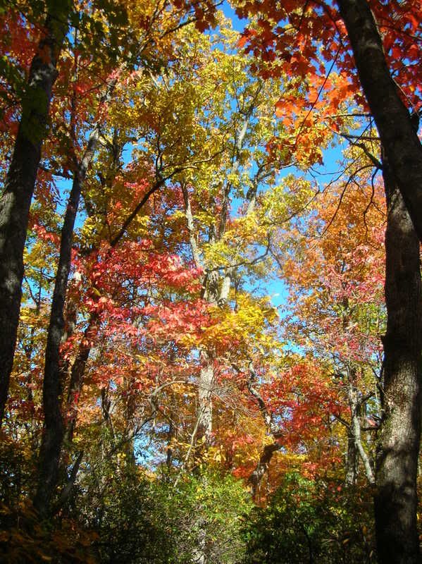
Though it couldn’t have been any nicer of a day when I got to the Hatchery I once again decided to bail on Butter but since I really wanted to check out the Horse Cove Rd. > Art Loeb > Connector > North Slope route back to the Ranger Station. I’d done it once last year but couldn’t remember how long the mandatory hike-a-bikes took so I headed up 475C to find out. Just after the turn for John Rock the road turns to a mossy grassy track and slowly meanders around Horse Cove. The cove itself is breathtaking and the gentle climb gives you plenty of time to take it in. As expected the climb took about 45 minutes to the turn on to the Art Loeb. The mandatory hike-a-bike starts at this point after after a quick check of my safety gear I headed off on my hike. The weather really could not have been any better and with the leaves in full bloom I wouldn’t have cared if I had to walk next to my bike for the rest of the day:
Most of the routes I do that incorporate hiking only trails have the hike-a-bike going up a climb so usually you couldn’t ride it even if you were allowed but this one is on a downhill so it is more than a little frustrating. You get to the turn onto the North Slope Connector in no time but that trail seems to go on forever and would be very sweet to ride. No matter how tempting I wasn’t willing to ride any of the hiking only stuff and did pass a few groups of hikers. This stretch is very close to the forest gate and the start of the Art Loeb so it sees heavy hiker traffic and should not be ridden no matter how tempting. After a realxing 45 or so minutes of hiking I made it to the North Slope. The Connector spits you out right at the top of the trail so all your hiking is rewarded with the sweetness that is the North Slope. This trail is fast and flowy with a few surprise little technical moves and seems to go in for much longer than it should. But as all things do it ends and after a quick spin through the campground was back at my truck after about five hours on the trail.
My entire route for the day was:
Black Mtn. > Buckwheat Knob > Bennett Gap > Coontree Gap > 276 > 475 > 475C > Art Loeb > Connector > North Slope


No comments:
Post a Comment